Home
Dominican Republic
Barnes and Noble
Loading Inventory...
Dominican Republic in Franklin, TN
Current price: $14.95
Barnes and Noble
Dominican Republic in Franklin, TN
Current price: $14.95
Loading Inventory...
Size: OS
• Waterproof • Tear-Resistant • Travel Map
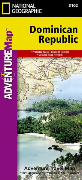
With a diverse landscape of tropical rainforests, rugged mountains, fertile valleys, arid deserts-like expanses and white sand beaches, the Dominican Republic is one of the most popular tourist destinations in all of the Americas. Let the expertly researched National Geographic's Dominican Republic Adventure Map serve as your guide as you explore this Caribbean Island nation. The front side details, with maps, photos and descriptions, someone of the countries most visited areas, including Metropolitan and Colonial Santo Domingo, Samana Peninsula, Del Este National Park, Lake Enriquillo and Pico Duarte. While the reverse side combines hundreds of points of interest, a detailed road network and topographic features, in one unparalleled map of the entire country, her islands and surrounding bodies of water.
A user-friendly index towns and protected areas, including forest reserves, national parks, natural monuments and wildlife refuges, will help you find your adventure site. Then plan your route with the mapped road network which includes primary and secondary roads, complete with distances, as well as tracks to help you travel off the beaten path. Additional transportation features mapped include airports, airstrips, ferry routes. sea ports and border crossings with Haiti. Mapped are cultural, historical, ecological and adventure points of interest, such as archeological sites and ruins, swamps, mangroves, coral reefs, shipwrecks, caves and areas for surfing, diving and fishing. Along with its abundance of travel tips and background information, the map is a complete travel guide to the country.
Every Adventure Map is printed on durable synthetic paper, making them waterproof, tear-resistant and tough — capable of withstanding the rigors of international travel.
Map Scale = 1:450,000
Sheet Size = 37.75" x 25.5"
Folded Size = 4.25" x 9.25"
• Waterproof • Tear-Resistant • Travel Map
With a diverse landscape of tropical rainforests, rugged mountains, fertile valleys, arid deserts-like expanses and white sand beaches, the Dominican Republic is one of the most popular tourist destinations in all of the Americas. Let the expertly researched National Geographic's Dominican Republic Adventure Map serve as your guide as you explore this Caribbean Island nation. The front side details, with maps, photos and descriptions, someone of the countries most visited areas, including Metropolitan and Colonial Santo Domingo, Samana Peninsula, Del Este National Park, Lake Enriquillo and Pico Duarte. While the reverse side combines hundreds of points of interest, a detailed road network and topographic features, in one unparalleled map of the entire country, her islands and surrounding bodies of water.
A user-friendly index towns and protected areas, including forest reserves, national parks, natural monuments and wildlife refuges, will help you find your adventure site. Then plan your route with the mapped road network which includes primary and secondary roads, complete with distances, as well as tracks to help you travel off the beaten path. Additional transportation features mapped include airports, airstrips, ferry routes. sea ports and border crossings with Haiti. Mapped are cultural, historical, ecological and adventure points of interest, such as archeological sites and ruins, swamps, mangroves, coral reefs, shipwrecks, caves and areas for surfing, diving and fishing. Along with its abundance of travel tips and background information, the map is a complete travel guide to the country.
Every Adventure Map is printed on durable synthetic paper, making them waterproof, tear-resistant and tough — capable of withstanding the rigors of international travel.
Map Scale = 1:450,000
Sheet Size = 37.75" x 25.5"
Folded Size = 4.25" x 9.25"