Home
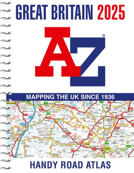
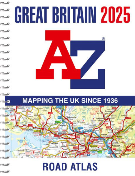
Great Britain A-Z Handy Road Atlas 2025 (A5 Spiral)
Barnes and Noble
Loading Inventory...
Great Britain A-Z Handy Road Atlas 2025 (A5 Spiral) in Franklin, TN
Current price: $14.99
Barnes and Noble
Great Britain A-Z Handy Road Atlas 2025 (A5 Spiral) in Franklin, TN
Current price: $14.99
Loading Inventory...
Size: OS
Navigate your way around Great Britain with this detailed and easy-to-use A-Z Road Atlas
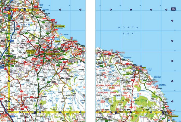
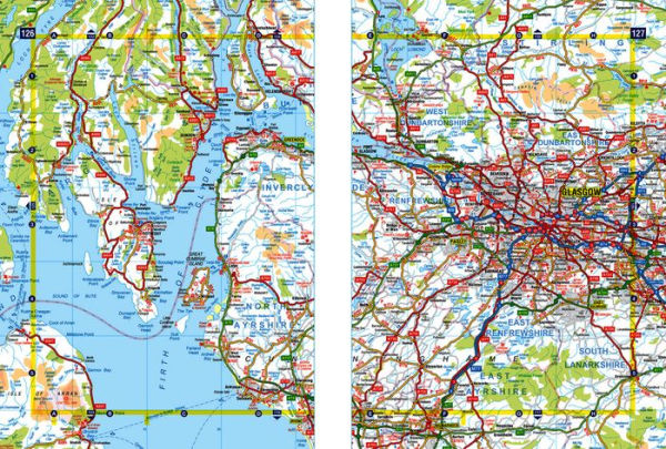
A full-color, spiral-bound road atlas, now fully revised and updated. Clear detailed road mapping at a scale of 5 miles to 1 inch. Presented in a compact A5 size for ease of storage.
This handy road atlas of Great Britain includes:
Mileage chart
Channel Tunnel terminus maps
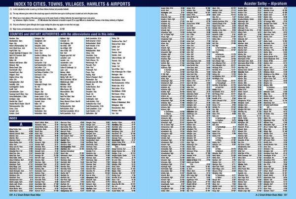
Index to cities, towns, villages, hamlets and major destinations
Map reference information also in French and German
Instantly recognizable and easy to use, the road mapping has been specifically tailored for the smaller scale featuring: clear standard road classification colours for easy identification, motorway junction symbols, under construction and proposed roads, primary route destinations, service areas, National and county boundaries, and a wide range of tourist and ancillary information, including Blue Flag Beaches.
This
A-Z Handy Road Atlas of Great Britain and Northern Ireland
is the perfect choice for those wanting a compact spiral-bound publication with A-Z quality road mapping.
A full-color, spiral-bound road atlas, now fully revised and updated. Clear detailed road mapping at a scale of 5 miles to 1 inch. Presented in a compact A5 size for ease of storage.
This handy road atlas of Great Britain includes:
Mileage chart
Channel Tunnel terminus maps
Index to cities, towns, villages, hamlets and major destinations
Map reference information also in French and German
Instantly recognizable and easy to use, the road mapping has been specifically tailored for the smaller scale featuring: clear standard road classification colours for easy identification, motorway junction symbols, under construction and proposed roads, primary route destinations, service areas, National and county boundaries, and a wide range of tourist and ancillary information, including Blue Flag Beaches.
This
A-Z Handy Road Atlas of Great Britain and Northern Ireland
is the perfect choice for those wanting a compact spiral-bound publication with A-Z quality road mapping.
Navigate your way around Great Britain with this detailed and easy-to-use A-Z Road Atlas
A full-color, spiral-bound road atlas, now fully revised and updated. Clear detailed road mapping at a scale of 5 miles to 1 inch. Presented in a compact A5 size for ease of storage.
This handy road atlas of Great Britain includes:
Mileage chart
Channel Tunnel terminus maps
Index to cities, towns, villages, hamlets and major destinations
Map reference information also in French and German
Instantly recognizable and easy to use, the road mapping has been specifically tailored for the smaller scale featuring: clear standard road classification colours for easy identification, motorway junction symbols, under construction and proposed roads, primary route destinations, service areas, National and county boundaries, and a wide range of tourist and ancillary information, including Blue Flag Beaches.
This
A-Z Handy Road Atlas of Great Britain and Northern Ireland
is the perfect choice for those wanting a compact spiral-bound publication with A-Z quality road mapping.

![National Geographic Road Atlas 2025: Scenic Drives Edition [United States, Canada, Mexico]](https://prodimage.images-bn.com/pimages/9781566957069_p0_v3_s600x595.jpg)