Home
SE VIRGINIA/RICHMOND TO HAMPTON ROADS REGIONAL MAP
Barnes and Noble
Loading Inventory...
SE VIRGINIA/RICHMOND TO HAMPTON ROADS REGIONAL MAP in Franklin, TN
Current price: $8.99
Barnes and Noble
SE VIRGINIA/RICHMOND TO HAMPTON ROADS REGIONAL MAP in Franklin, TN
Current price: $8.99
Loading Inventory...
Size: OS
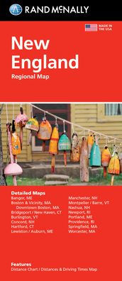
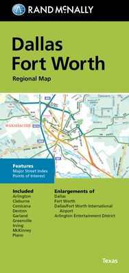
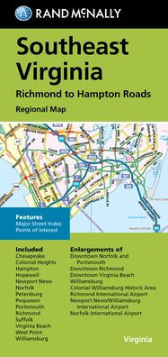
Rand McNally's folded map for Southeast Virginia Richmond to Hampton Roads is a must-have for anyone traveling in and around this part of Virginia, offering unbeatable accuracy and reliability at a great price. Our trusted cartography shows all Interstate, U.S., state, and county highways, along with clearly indicated parks, points of interest, airports, county boundaries, and streets. The easy-to-use legend and detailed index make for quick and easy location of destinations. You'll see why Rand McNally folded maps have been the trusted standard for years. - Regularly updated. - Full-color maps. - Clearly labeled Interstate, U.S., state, and county highways. - Indications of parks, points of interest, airports, county boundaries, downtown & vicinity maps. - Major attractions & Golf Courses. - Enlargements of Norfolk and Portsmouth downtown, Richmond downtown, Virginia Beach downtown, Williamsburg, Colonial Williamsburg Historic Area, Richmond Int'l Airport, Newport News/Williamsburg Int'l Airport, Norfolk Int'l Airport. - Easy-to-use legend. - Detailed index & Major Street Index. - Convenient folded size. Coverage Area: Chesapeake, Colonial Heights, Hampton, Hopewell, Newport News, Norfolk, Petersburg, Poquoson, Portsmouth, Richmond, Suffolk, Virginia Beach, West Point, Williamsburg. Product Details: Measures 9.5 x 4 and folds out to 40 x 28
Rand McNally's folded map for Southeast Virginia Richmond to Hampton Roads is a must-have for anyone traveling in and around this part of Virginia, offering unbeatable accuracy and reliability at a great price. Our trusted cartography shows all Interstate, U.S., state, and county highways, along with clearly indicated parks, points of interest, airports, county boundaries, and streets. The easy-to-use legend and detailed index make for quick and easy location of destinations. You'll see why Rand McNally folded maps have been the trusted standard for years. - Regularly updated. - Full-color maps. - Clearly labeled Interstate, U.S., state, and county highways. - Indications of parks, points of interest, airports, county boundaries, downtown & vicinity maps. - Major attractions & Golf Courses. - Enlargements of Norfolk and Portsmouth downtown, Richmond downtown, Virginia Beach downtown, Williamsburg, Colonial Williamsburg Historic Area, Richmond Int'l Airport, Newport News/Williamsburg Int'l Airport, Norfolk Int'l Airport. - Easy-to-use legend. - Detailed index & Major Street Index. - Convenient folded size. Coverage Area: Chesapeake, Colonial Heights, Hampton, Hopewell, Newport News, Norfolk, Petersburg, Poquoson, Portsmouth, Richmond, Suffolk, Virginia Beach, West Point, Williamsburg. Product Details: Measures 9.5 x 4 and folds out to 40 x 28