Home
Washington Guide Map
Barnes and Noble
Loading Inventory...
Washington Guide Map in Franklin, TN
Current price: $9.95
Barnes and Noble
Washington Guide Map in Franklin, TN
Current price: $9.95
Loading Inventory...
Size: OS
• Waterproof • Tear-Resistant • Travel Map
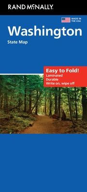
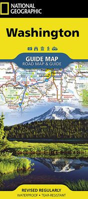
National Geographic's Washington Guide Map is designed to meet the needs of travelers with detailed and accurate cartography and loads of helpful information about the state's many attractions. Cities and towns are clearly indicated and easy to find in the user-friendly index. A complete road network of highways, tollways, and other roads, along with distances noted in miles for major highways, will help you find the route that's right for you. National and state parks, public campsites, visitor information centers, airports, ski areas, ports of entry, and more are shown.
Inset maps of Olympia, Yakima, Spokane, and Seattle provide greater detail of these urban centers. Olympic, Mount Rainier, and North Cascades national parks, and Mount Adams Scenic Drive are highlighted with maps and additional information to help visitors take advantage of the many sites and recreation activities available in these regions. A handy chart of park service sites and climate information are also included. Whether your travels in Washington bring you to its cities or its most remote wilderness areas, you'll find this map to be an invaluable tool for exploring all the state has to offer.
Every State Guide Map is printed on durable synthetic paper, making them waterproof, tear-resistant and tough — capable of withstanding the rigors of any kind of travel.
Map Scale = 1:1,267,000
Sheet Size = 24.75" x 17.75"
Folded Size = 4" x 8.75"
• Waterproof • Tear-Resistant • Travel Map
National Geographic's Washington Guide Map is designed to meet the needs of travelers with detailed and accurate cartography and loads of helpful information about the state's many attractions. Cities and towns are clearly indicated and easy to find in the user-friendly index. A complete road network of highways, tollways, and other roads, along with distances noted in miles for major highways, will help you find the route that's right for you. National and state parks, public campsites, visitor information centers, airports, ski areas, ports of entry, and more are shown.
Inset maps of Olympia, Yakima, Spokane, and Seattle provide greater detail of these urban centers. Olympic, Mount Rainier, and North Cascades national parks, and Mount Adams Scenic Drive are highlighted with maps and additional information to help visitors take advantage of the many sites and recreation activities available in these regions. A handy chart of park service sites and climate information are also included. Whether your travels in Washington bring you to its cities or its most remote wilderness areas, you'll find this map to be an invaluable tool for exploring all the state has to offer.
Every State Guide Map is printed on durable synthetic paper, making them waterproof, tear-resistant and tough — capable of withstanding the rigors of any kind of travel.
Map Scale = 1:1,267,000
Sheet Size = 24.75" x 17.75"
Folded Size = 4" x 8.75"